

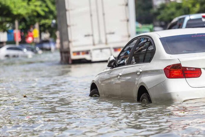
Flash floods shut down highways, swamped neighborhoods, and forced evacuations across Arizona this week as emergency crews worked at full capacity to pull people from rising water.
Story Snapshot
- Flagstaff officials closed numerous roads and urged residents to avoid travel as floodwater overwhelmed the city.
- The National Weather Service warned of deadly flooding over low-water crossings and told drivers to obey closures.
- Arizona’s Department of Transportation shut down major highways, including stretches of Interstate 17, before later reopening some routes.
- Communities beyond Flagstaff, including Sedona and Camp Verde, also saw evacuations as rivers rose fast.
Floodwater Shuts Down Flagstaff Streets
The City of Flagstaff issued an urgent public notice telling residents and visitors to stay off the roads. Flooding had caused widespread closures across the city, including parts of South Milton Road, Route 66, Butler Avenue, East Huntington Drive, and South Lone Tree Road. City officials said emergency response crews were already operating at full capacity.
The National Weather Service backed up that warning with its own flood alert for Flagstaff. The agency said excessive rainfall kept driving flooding across Coconino County, leaving roads closed and impassable. Forecasters specifically warned that low-water crossings could turn deadly, a blunt reminder that calm-looking water can still sweep away a vehicle in seconds.
Specific Waterways Named in Federal Warnings
Weather Service officials pinpointed the exact waterways driving the danger. The Rio de Flag, Walnut Creek, Pumphouse Wash, Schoolhouse Draw, and Schultz Creek all posed flood risks, along with a stretch of Route 66 between mile markers 192 and 202. A separate flash-flood statement from the agency put it plainly: flooding was occurring and would keep going into the evening, telling residents to obey every road closure and never drive into floodwater.
That warning carries extra weight in Flagstaff because of the area’s history. Schultz Creek runs through land scarred by the 2022 Pipeline Fire, which burned more than 26,000 acres and left the watershed far more prone to dangerous runoff during heavy rain. City flood guidance already tells residents that a car can float in as little as a foot of water and warns drivers never to cross barricades, risk-avoidance advice that explains why officials moved fast even before every road was confirmed underwater.
Highways Closed, Then Reopened as Storms Shifted
Arizona’s Department of Transportation shut down major routes in northern Arizona because of flood danger, including Interstate 17 northbound at State Route 179 and the southbound lanes near Flagstaff Pulliam Airport. Crews later reopened Interstate 17 once conditions improved, while other roads stayed closed longer. Local reporting also confirmed a water rescue carried out by Flagstaff fire officials on a flooded city street.
The flooding did not stop at Flagstaff’s city limits. Evacuations hit Sedona, Camp Verde, and the White River area as storms pushed through the region, and at least one person was reported missing in the broader flooding event. Photos and video from across Arizona showed flooded streets and rescue crews working through the weekend, underscoring how widespread the storm system’s impact became.
Flood Warning for Flagstaff: Flooding caused by excessive rainfall continues. Where: Coconino County in north central Arizona, Navajo County in north central Arizona, Apache County in northeastern Arizona, When: Until 100 PM MST Monday. Impacts: Roads …https://t.co/l2ORRVF7uA
— Flagstaff Weather (@_FlagstaffAZ) November 2, 2026
For readers who value personal responsibility and common sense over bureaucratic foot-dragging, this storm is a case study in local government doing its basic job. Flagstaff officials didn’t wait for a committee meeting or a press conference tour. They posted the warning, named the roads, and told people to stay home. The Weather Service backed them up with specific, technical detail rather than vague alarmism. That’s how public safety is supposed to work.
None of this means every closure decision will be perfectly documented in real time. Officials have not yet released rainfall totals, stream-gauge readings, or a full closure timeline for every affected road. But the core facts are not in dispute: heavy rain hit a fire-scarred watershed, rivers rose fast, and Arizona’s emergency agencies closed roads and pulled people out of harm’s way before anyone got hurt.
Sources:
youtube.com, flagstaff.az.gov, forecast.weather.gov, ktar.com, kvoa.com, tucson.com, jacksonville.com